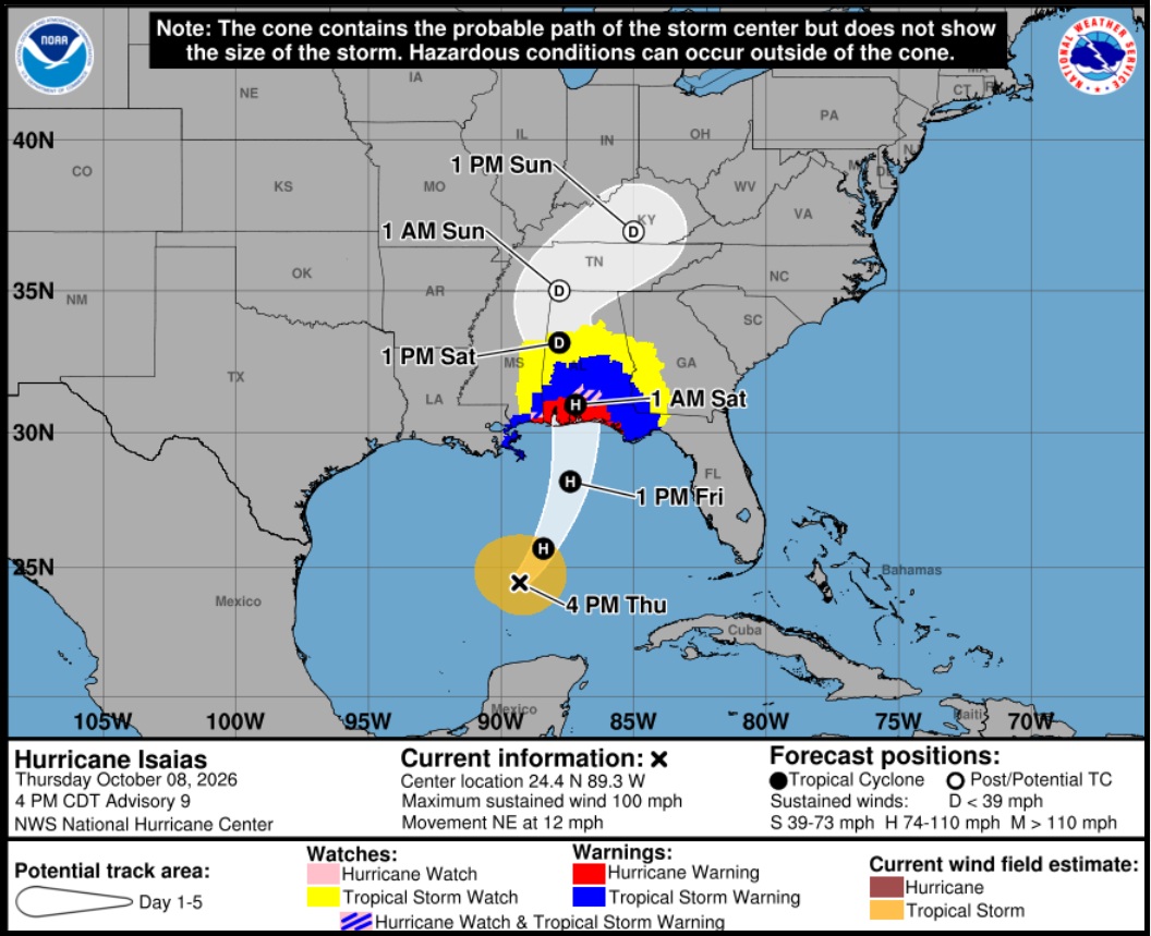
Hurricane Isaias continues nearly on the predicted track while the intensity forecast remains a challenge. No substantive changes to the overall thinking. Outdoor preparations and home-hardening in advance of the hurricane should be completed by early tomorrow. Inland residents should prepare for power outages due to excessively high wind gusts.
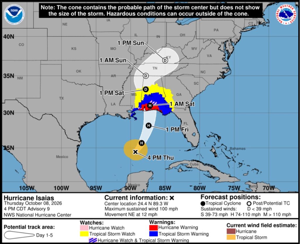
[National Hurricane Center] – At 400 PM CDT (2100 UTC), the eye of Hurricane Isaias was located near latitude 24.4 North, longitude 89.3 West. Isaias is moving toward the northeast near 12 mph (19 km/h). A turn toward the north is expected on Friday. On the forecast track, Isaias is expected to pass to the north of the Yucatan Peninsula through this evening and make landfall along the U.S. northern Gulf Coast within the warning area late Friday or early Saturday.
Maximum sustained winds have increased to near 100 mph (155 km/h) with higher gusts. Additional strengthening is expected through early Friday, and Isaias should remain a dangerous hurricane as it approaches the northern Gulf Coast Friday night.
Hurricane-force winds extend outward up to 15 miles (30 km) from the center and tropical-storm-force winds extend outward up to 125 miles (205 km). The estimated minimum central pressure is 975 mb (28.80 inches). (more)
A hurricane watch is in effect from Bay St. Louis, Mississippi, to Indian Pass, Florida. A storm surge watch is in effect from the mouth of the Mississippi River in Louisiana to Yankeetown, Florida. {Nat Hurricane Center} Those in the forecast areas are strongly advised to pay close attention to local officials and heed all evacuation orders.
(more…)

 Our Father, who art in heaven, hallowed be thy Name. Thy kingdom come. THY WILL BE DONE, on earth as it is in heaven. Give us this day our daily bread. And forgive us our trespasses, as we forgive those who trespass against us. And lead us not into temptation, but DELIVER US FROM EVIL.