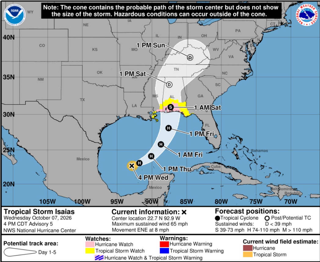
Tropical Storm Isaias is forecast to track northeastward and quickly ramp up to a hurricane while over the central Gulf in the next several hours. Landfall along the central Gulf Coast is expected Friday night or Saturday morning as a strong Category 2 storm. Residents in the FL panhandle, MS, LA and AL should pay attention to local forecasts.
A hurricane watch is in effect from Bay St. Louis, Mississippi, to Indian Pass, Florida. A storm surge watch is in effect from the mouth of the Mississippi River in Louisiana to Yankeetown, Florida. {Nat Hurricane Center} Those in the forecast areas are strongly advised to pay close attention to local officials and heed all evacuation orders.
[SOURCE]
Check your hurricane supplies of shelf-stable food, water, medicine and don’t forget pets. Prepare for the worst and hope for the best. Everything is replaceable, except you and your family. We have a lot of Treepers in the path of this storm. If you need assistance, use the comments section of any ‘Isaias Update thread’ to reach out, or use the email address in the upper right of the site.
Right now, you are in control. Have a solid plan, work that plan – stay busy, and don’t get caught up in the hysteria. Try to avoid national media hype. Stay updated via your local news stations. Friday morning looks like the key day impact zones will be identified. Reach out to your neighbors; touch-base and check to see if they are okay or need anything. Community restoration begins before the storm arrives. Look out for each-other.
Remember the inland lessons in Tennessee and Western North Carolina from Hurricane Helene. Regarding any evacuation plan, please pay attention to your local officials who will be coordinating with state Dept. of Transportation. As the path and impact zone of the storm becomes more predictable your local officials will alert to best route(s) for evacuation.