
Information from the National Hurricane Center [DATA HERE] indicates currently slow-moving Tropical Storm Idalia will likely speed up quickly tomorrow and form a Hurricane in the Gulf of Mexico on Tuesday. The current cone of uncertainty puts the Northern and Western portion of Florida at greatest risk.
At 100 PM CDT (1800 UTC), the center of Tropical Storm Idalia was located near latitude 20.0 North, longitude 85.8 West. Idalia is moving toward the north near 2 mph (4 km/h), and it is likely to meander near the Yucatan Channel through tonight. A faster motion toward the north is expected on Monday, bringing the system over the eastern Gulf of Mexico.
Maximum sustained winds remain near 40 mph (65 km/h) with higher gusts. Strengthening is forecast, and Idalia is expected to become a hurricane by Tuesday.
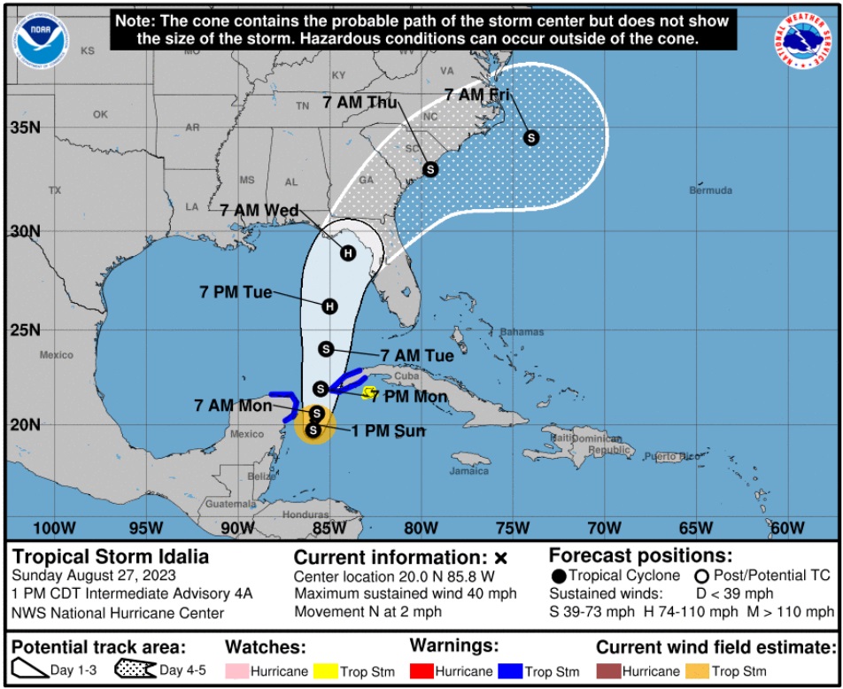
Idalia will come fast, most likely making landfall at a category 2 hurricane. Those in the cone of uncertainty should pay attention, and people in the Tampa and St Pete region who have really lucked out in the past 30 years, should pay very close attention.
I hope you will understand why my proactive tips, advice and planning have modified since our experience with the September 2022 Hurricane, Ian. {Go Deep} Thankfully Idalia is not expected to be anything similar to Ian. However, for those in the Tampa/St Pete area, do not be complacent. This is a large metropolitan area with a similar demographic to the impact zone of Ian.
 “This is no small thing, to restore a republic after it has fallen into corruption. I have studied history for years and I cannot recall it ever happening. It may be that our task is impossible. Yet, if we do not try then how will we know it can’t be done? And if we do not try, it most certainly won’t be done. The Founders’ Republic, and the larger war for western civilization, will be lost.”


 1.) First, please READ THIS ENTIRELY – and the full text of any discussion you wish to participate in.