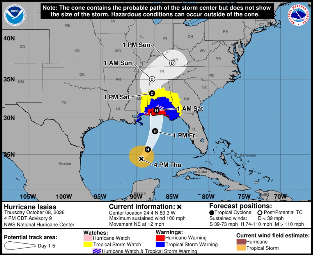
The National Hurricane Center is narrowing the forecast path of Hurricane Isaias, while strongly emphasizing the importance of preparation for a dangerous storm impact in the western Florida panhandle region and Mississippi delta. Everyone in the area should pay close attention, inland flooding will be a concern.
Isaias is anticipated to intensify just prior to landfall over warm water overnight tonight and start moving forward very quickly. This can push the wind driven water very severely into the northern Florida panhandle region and coastal area. The storm surge can be very dangerous. Coastal evacuations are beginning and all preparation should be rushed to completion.
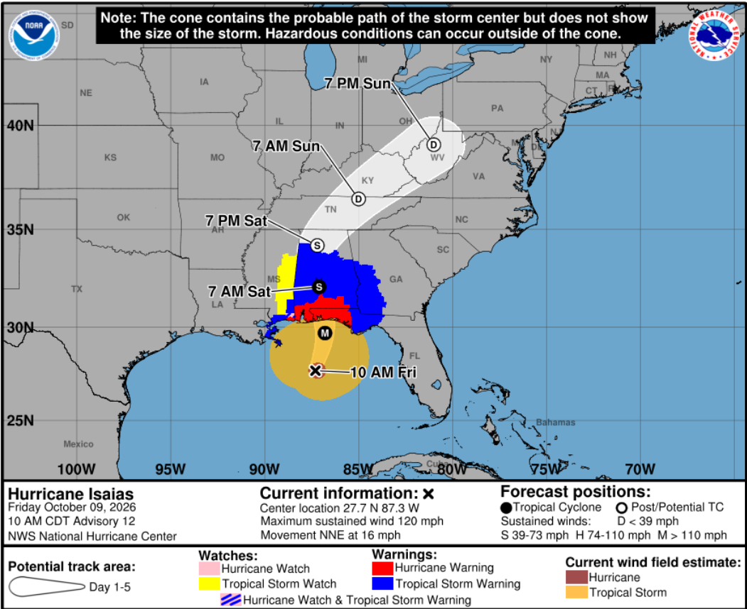
[National Hurricane Center] – At 1000 AM CDT (1500 UTC), the center of Hurricane Isaias was located near latitude 27.7 North, longitude 87.3 West. Isaias is moving toward the north-northeast near 16 mph (26 km/h). This motion is expected to continue through this evening, followed by a northward motion on Saturday. On the forecast track, Isaias is expected to approach the U.S. northern Gulf Coast this afternoon and make landfall within the warning area this evening.
Maximum sustained winds are near 120 mph (195 km/h) with higher gusts. Isaias is a category 3 hurricane on the Saffir-Simpson Hurricane Wind Scale. Fluctuations in intensity are possible through this afternoon, but Isaias is expected to be at or near major hurricane strength when it makes landfall this evening. Weakening is expected beginning tonight after Isaias makes landfall, and the storm is likely to become post-tropical by late Saturday.
Hurricane-force winds extend outward up to 35 miles (55 km) from the center and tropical-storm-force winds extend outward up to 205 miles (335 km). (more)
Communication is important. Update your friends and family contact list. Stay in touch with family and friends, let them know your plans. Select a single point of contact for communication from you that all others can then contact for updates if needed.
CTH Recommendations for solid Prep ARE HERE
The buzzsaw for Isaias is approximately 70 miles at current conditions (35 miles from center). This is the area of greatest wind damage. Hurricanes spin counterclockwise. The coastal flooding will be most extreme on the right side of Isaias as the wind pushes the water toward the coastline.