I am certainly no expert on North Carolina politics, but what I can tell you after watching this interview is that North Carolina Governor Roy Cooper is completely incapable of dealing with the catastrophic crisis unfolding right now in WESTERN NORTH CAROLINA.
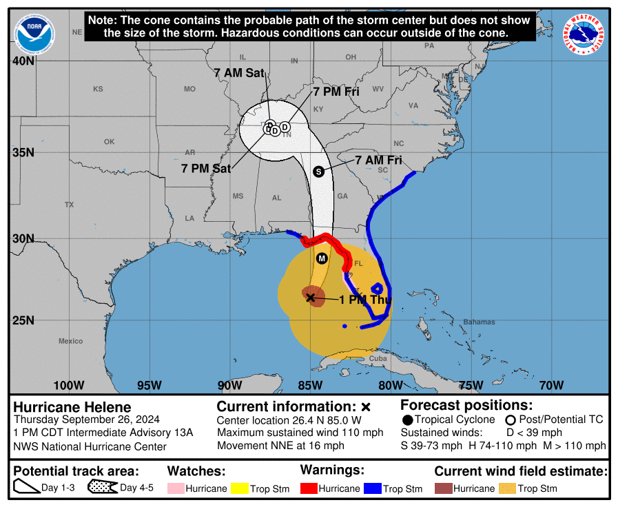
Far-east Tennessee and Western North Carolina are cut-off from the rest of the world. Not only have the main artery roads, interstates and bridges been wiped out, but also communication lines, fiber optic cables, transmission towers, cell towers, the works have been destroyed.
If you remember the communication blackout, and subsequent slow rolling information stream that took four days to surface in the aftermath of Hurricane Katrina (2005), you will have reference for why it is taking the nation so long to realize what is happening in Western NC.
The video below is exactly what you do not want to see in this situation.
Last night Governor Roy Cooper delivered a shocking “exclusive interview” with WLOS News 13. What makes the interview “shocking” is not just what Cooper says, but the manner in which he says it. This guy is in a bubble without any concept of what is happening on the ground. This interview represents everything you NEVER WANT TO SEE, in a state of emergency. WATCH:
First, Governor Roy Cooper is isolated and alone. There are no state emergency officials next to him. He is not in an emergency response posture; nor is he in a coordination center with the officials that matter. 15 minutes of time during a period of extreme crisis is a lot of time to waste. This should be a press conference with every state emergency official, from every responding agency, surrounding him to offer specifics on what they are doing.