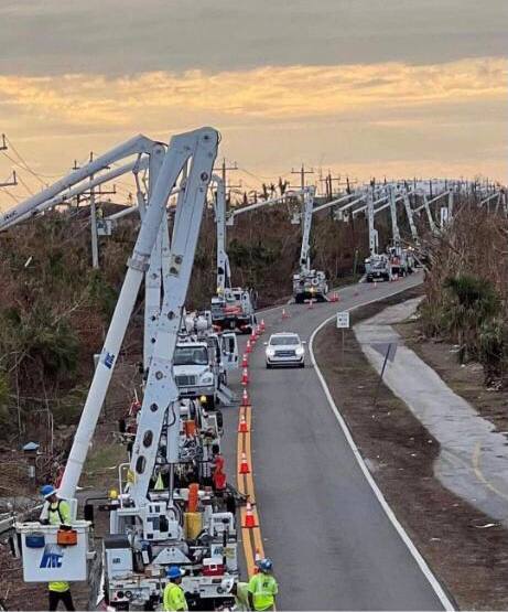
Sometimes the knights in shining armor appear as crews’ wearing jeans, overalls and steel toed boots.
It doesn’t take an emergency beacon to activate them, just a need… and they come. Purposefully, without condition, ready to move, activate and respond. They throw the gear bags, kiss the ladies & babies, and head out. The rest is figured out upon arrival.
Superior Construction, came from Jacksonville, Ajax Paving from Fort Myers, Honc from the Cape and trucks with subs from just about everywhere. There’s both a unity and similarity that flows when callouses are clasped and the melding of purpose comes together. Few words are needed, because it’s a task centered outlook, let’s git r’ done – no quit.
I asked Richard to put this together. {Direct Ruble Link} The drone video is from FAI photography. The song is by Lucy Thomas. The message, well, given all of the critics who say America’s best days are behind, perhaps they need to pause a little bit and remind themselves what we are capable of. Enjoy:
.
What has been accomplished in two weeks of 24/7 reconstruction is nothing short of remarkable. Then again, this is the Christian America we know well. The truckers, pullers, spreaders, drivers, welders, machinists, heavy equipment operators, tugboat operators, barge haulers, diggers, pumpers, tradesmen, all of them, just people.
Damn good people at that.
People who represent what makes our nation unique. The invisible, salty, mostly scruffy and beautifully comfortable about it, yet critical network of blue-collar crews that keeps it all operating. God, how I cherish them so.
At the core of our American purpose is a decency and unity. Critics don’t like to talk about it, but American workers are fundamentally good. When something seems impossible, for blue-collar Americans ‘impossible‘ is just another starting point, if you get out of the way. Don’t lose sight of that.
(more…)


 What you do before the hurricane hits is going to determine where you are in the recovery phase.
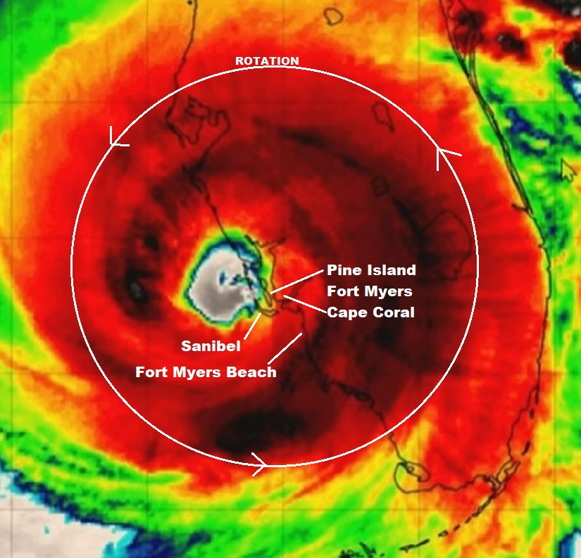
 First things first. To establish the context, what made Ian completely different from all other hurricane recovery responses I have been involved in comes down to two issues: strength of the storm (155+ mph winds), and more importantly the duration of the event (8+ hours of peak destruction).