There are only two words that come to mind as I write this notice from the Ian impact zone, “mercy” and “uncle.” Prayers.
STS Nicole is anticipated to become a Cat-1 Hurricane as it approaches the southeast coast of Florida late Wednesday night. A Hurricane warning is in effect for the Northeast Bahamas, and a Hurricane Watch is in effect for the East Coast of Florida from the Volusia/Brevard County Line to Hallandale Beach. Residents along the Florida east coast should watch for updates [Hurricane Center Link].
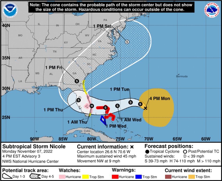
If you are on the east coast of Florida, you should begin preparations today and tomorrow for the potential of high winds, power outages, coastal storm surge and inland flooding. Georgia and South Carolina should also keep an eye on this.
Additionally, on the other side of the state, while Nicole is not anticipated to be a strong hurricane and will hopefully lose strength quickly as it moves over land, any tropical storm winds and rain along the southwest Florida areas (SWFL) previously impacted by Ian could be very troublesome. Everything is tenuously held together in SWFL and there is massive debris and structural instability present as recovery efforts continue. This is not good.
(NHC) – At 400 PM EST (2100 UTC), the center of Subtropical Storm Nicole was located near latitude 26.6 North, longitude 70.6 West. The storm is moving toward the northwest near 9 mph (15 km/h). A slower northwestward motion is expected tonight. A turn toward the west or west-southwest is forecast to begin by Tuesday night and that motion should continue through early Thursday. On the forecast track, the center of Nicole will approach the northwestern Bahamas on Tuesday and Tuesday night, move near or over those islands on Wednesday, and approach the east coast of Florida Wednesday night. (more)
(more…)
 Our Father, who art in heaven, hallowed be thy Name. Thy kingdom come. THY WILL BE DONE, on earth as it is in heaven. Give us this day our daily bread. And forgive us our trespasses, as we forgive those who trespass against us. And lead us not into temptation, but DELIVER US FROM EVIL.
 So, this thread is for you to share what the sense is around your community. How motivated are the people in your neighborhood? What is the sense of this election cycle? If you have voted already, how was the turnout for early voting in/around your area?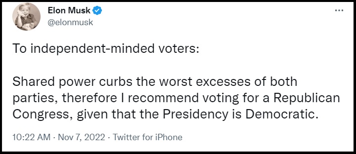
 Is it possible Senator Cotton’s visits gave him more exposure him to the MAGA base and provided additional insight into what & who voters support?
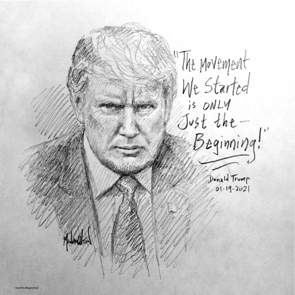 “This is no small thing, to restore a republic after it has fallen into corruption. I have studied history for years and I cannot recall it ever happening. It may be that our task is impossible. Yet, if we do not try then how will we know it can’t be done? And if we do not try, it most certainly won’t be done. The Founders’ Republic, and the larger war for western civilization, will be lost.”