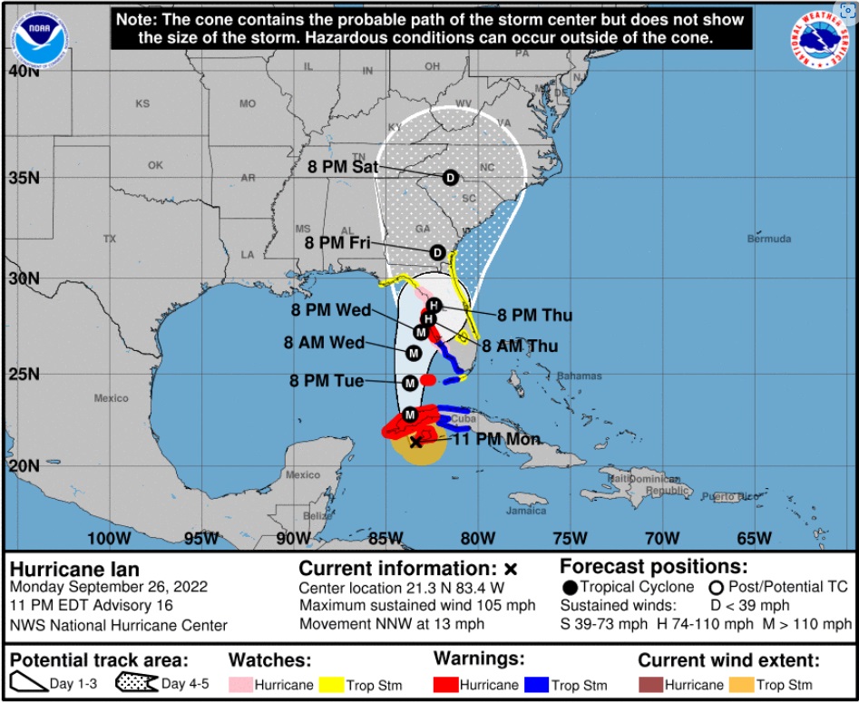
[National Hurricane Center Data] As of 11:00am ET Tuesday, Hurricane Ian has maximum sustained winds of 115 mph [Category 3]. Ian is anticipated to continue strengthening in the next 24 hours as it enters the Gulf of Mexico as a major hurricane [Cat 3+]. All west coast Florida residents from Bonita Springs to Tampa should use Today to finalize their hurricane preparations.
Today is the last good weather day to finish your preparations and secure your property. Do not be alarmed but do take this hurricane seriously. This is not a ‘wait and see’ type storm. All reasonable precautions should be completed today, and all coastal residents are urged to pay close attention to local officials for evacuation orders. Each locality is different, each coastal locality has a zone of potential flooding and storm surge. As a general rule, hunker down from wind – but evacuate from water.
[NHC] At 1100 AM EDT (1500 UTC), the center of Hurricane Ian was located near latitude 23.0 North, longitude 83.5 West. Ian is moving toward the north near 10 mph (17 km/h), and this motion is expected to continue today. A turn toward the north-northeast with a reduction in forward speed is forecast tonight and Wednesday. On the forecast track, the center of Ian is expected to move over the southeastern Gulf of Mexico in a couple of hours, pass west of the Florida Keys later today, and approach the west coast of Florida within the hurricane warning area on Wednesday and Wednesday night. (more)

Official projections now put the storm further east and slightly south, just off the Florida southwest coast on Wednesday night, with the potential for a 24-hour duration cycle. That is an alarming amount of time for a major hurricane to be centered near or on the coast. That is a minimum of two tidal cycles, which will make a big difference from prior hurricanes in terms of flooding and the potential for a historic storm surge into inland waterways.